- Home
- Transportation
- Transportation News
- Drones to Control Man Animal Conflict Around Indian Forests
Drones to Control Man-Animal Conflict Around Indian Forests

If things go according to plan, drones may soon come to the rescue of those caught in conflict with wild animals.
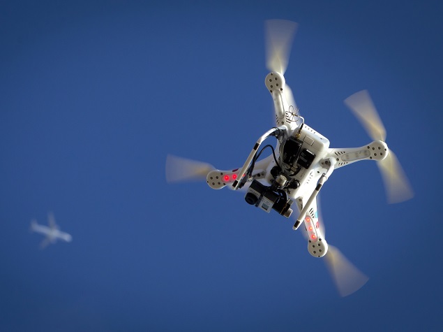
Scientists at the Wildlife Institute of India (WII) in Dehradun have decided to use drone technology as a tool to control the increasing cases of man-animal conflict in and around forest areas.
"Besides regular surveillance of our wildlife, we have found that drones can also be used for conflict resolution. We can fly these machines at short distances on the periphery of our forests to track if any large mammal like a tiger or elephant has strayed into the nearby villages," WII's wildlife scientist K Ramesh, in-charge of the project, told PTI.
In cases where the villagers notice that a wild animal is lurking dangerously close to human habitat, they can inform the forest department who can fly a drone fitted with GPS device and hi-resolution cameras in the area to find out the exact location of the animal.
"It would then be driven back to the forest by officials," Ramesh said.
According to experts, drones can be particularly useful in detecting movement of elephants which often create havoc in villages as they look around for food while crossing forests. Corbett Tiger Reserve's field director Samir Sinha said technology like those of unmanned aerial vehicles (UAVs) will create a big difference in wildlife management.
"If you have an eye in the sky then it generates lot of information. We can plan intervention and protect both people and wildlife," he said. Sundarban Biosphere Reserve director Pradeep Vyas said drones would be a force multiplier for them.
"We can scan an area of say about 15-20 sq km by sitting at one particular location. It will give us lot of information so the possibilities are endless," he said.
Following trials at Panna tiger reserve in Madhya Pradesh, WII is improvising on its UAV's to include additional features like night vision capability, landing capacity, increased duration, and speed of flights, etc.
"We are also changing the air frame so that it can fly in rains. We also want to add capabilities to load equipment like radio tracking device, etc," he said.
The Union Ministry of Environment, Forest and Climate Change had recently cleared a project by National Tiger Conservation Authority and WII to deploy drones in select forests around the country for monitoring and surveillance.
In the first phase, drones would fly in the forests of Panna, Jim Corbett National Park, Kaziranga, Sundarbans, and the Sathyamangalam forest of Tamil Nadu.
"We will start work as soon as we get a nod from the Directorate General of Civil Aviation (DGCA) and the Ministry of Defence. The Ministry of Home Affairs has already given us an NOC," the WII scientist said.
Flying at an average speed of 40 km per hour, UAVs can reach a height of around 100 metres. In each site, 2-3 drones would be deployed. After getting trained, forest department personnel would use it according to their need.
The design and features of the machines would be customised according to the geography of the forest.
Sathyamangalam, for example, has hilly terrain while Sundarbans has dense coastal mangrove forests. The woods in Panna are interspersed with grassland areas.
For the latest tech news and reviews, follow Gadgets 360 on X, Facebook, WhatsApp, Threads and Google News. For the latest videos on gadgets and tech, subscribe to our YouTube channel. If you want to know everything about top influencers, follow our in-house Who'sThat360 on Instagram and YouTube.
Related Stories
- Samsung Galaxy Unpacked 2025
- ChatGPT
- Redmi Note 14 Pro+
- iPhone 16
- Apple Vision Pro
- Oneplus 12
- OnePlus Nord CE 3 Lite 5G
- iPhone 13
- Xiaomi 14 Pro
- Oppo Find N3
- Tecno Spark Go (2023)
- Realme V30
- Best Phones Under 25000
- Samsung Galaxy S24 Series
- Cryptocurrency
- iQoo 12
- Samsung Galaxy S24 Ultra
- Giottus
- Samsung Galaxy Z Flip 5
- Apple 'Scary Fast'
- Housefull 5
- GoPro Hero 12 Black Review
- Invincible Season 2
- JioGlass
- HD Ready TV
- Laptop Under 50000
- Smartwatch Under 10000
- Latest Mobile Phones
- Compare Phones
- Moto G15 Power
- Moto G15
- Realme 14x 5G
- Poco M7 Pro 5G
- Poco C75 5G
- Vivo Y300 (China)
- HMD Arc
- Lava Blaze Duo 5G
- Asus Zenbook S 14
- MacBook Pro 16-inch (M4 Max, 2024)
- Honor Pad V9
- Tecno Megapad 11
- Redmi Watch 5
- Huawei Watch Ultimate Design
- Sony 65 Inches Ultra HD (4K) LED Smart TV (KD-65X74L)
- TCL 55 Inches Ultra HD (4K) LED Smart TV (55C61B)
- Sony PlayStation 5 Pro
- Sony PlayStation 5 Slim Digital Edition
- Blue Star 1.5 Ton 3 Star Inverter Split AC (IC318DNUHC)
- Blue Star 1.5 Ton 3 Star Inverter Split AC (IA318VKU)


