- Home
- Science
- Science News
- Nasa Releases First Ever Global Topographic Model of Mercury
Nasa Releases First-Ever Global Topographic Model of Mercury

It will also pave the way for scientists to fully characterise Mercury's geologic history.
"The wealth of these data has already enabled and will continue to enable exciting scientific discoveries about Mercury for decades to come," said Susan Ensor, software engineer at The Johns Hopkins University's Applied Physics Laboratory (APL).
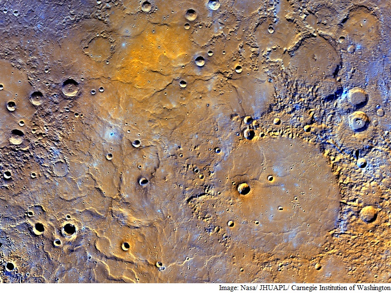
This new model reveals a variety of interesting topographic features, including the highest and lowest points on the planet.
The highest elevation on Mercury is at 4.48 km above Mercury's average elevation, located just south of the equator in some of Mercury's oldest terrain.
The lowest elevation, at 5.38 km below Mercury's average, is found on the floor of Rachmaninoff basin, an intriguing double-ring impact basin suspected to host some of the most recent volcanic deposits on the planet.
More than 100,000 images were used to create the new model.
"This has become one of my favourite maps of Mercury. Now that it is available, I'm looking forward to it being used to investigate this epic volcanic event that shaped Mercury's surface," added Nancy Chabot, instrument scientist for the Mercury Dual Imaging System (MDIS) in a Nasa statement.
"During its four years of orbital observations,Messenger revealed the global characteristics of one of our closest planetary neighbours for the first time.
The data from the mission will continue to be utilised by the planetary science community for years to come.
Get your daily dose of tech news, reviews, and insights, in under 80 characters on Gadgets 360 Turbo. Connect with fellow tech lovers on our Forum. Follow us on X, Facebook, WhatsApp, Threads and Google News for instant updates. Catch all the action on our YouTube channel.
Related Stories
- Samsung Galaxy Unpacked 2025
- ChatGPT
- Redmi Note 14 Pro+
- iPhone 16
- Apple Vision Pro
- Oneplus 12
- OnePlus Nord CE 3 Lite 5G
- iPhone 13
- Xiaomi 14 Pro
- Oppo Find N3
- Tecno Spark Go (2023)
- Realme V30
- Best Phones Under 25000
- Samsung Galaxy S24 Series
- Cryptocurrency
- iQoo 12
- Samsung Galaxy S24 Ultra
- Giottus
- Samsung Galaxy Z Flip 5
- Apple 'Scary Fast'
- Housefull 5
- GoPro Hero 12 Black Review
- Invincible Season 2
- JioGlass
- HD Ready TV
- Laptop Under 50000
- Smartwatch Under 10000
- Latest Mobile Phones
- Compare Phones
- OPPO A6v 5G
- OPPO A6i+ 5G
- Realme 16 5G
- Redmi Turbo 5
- Redmi Turbo 5 Max
- Moto G77
- Moto G67
- Realme P4 Power 5G
- HP HyperX Omen 15
- Acer Chromebook 311 (2026)
- Lenovo Idea Tab Plus
- Realme Pad 3
- HMD Watch P1
- HMD Watch X1
- Haier H5E Series
- Acerpure Nitro Z Series 100-inch QLED TV
- Asus ROG Ally
- Nintendo Switch Lite
- Haier 1.6 Ton 5 Star Inverter Split AC (HSU19G-MZAID5BN-INV)
- Haier 1.6 Ton 5 Star Inverter Split AC (HSU19G-MZAIM5BN-INV)


