In Pics: Tsunami Warning System
-
 1/7
1/7In Pics: Tsunami Warning System
The System The Envirtech Tsunami warning system works as a collection of five different modules: - Underwater module, surface module, linking segment, onshore station, satellite link
-
 2/7
2/7In Pics: Tsunami Warning System
Poseidon class – Underwater Module These devices are installed in the sea to measure the Tsunami. Typically the deployment distance is more than 1000 Km off shore. The maximum deployment depth is 5000 meters. It can detect the Tsunami waves up to one hour before they hit the shore
-
 3/7
3/7In Pics: Tsunami Warning System
Vulcun class – Underwater Module Another kind of underwater module, the Vulcun class is used where the coastal region is too close to the suspected tsunami-genic source. They have the capability to detect more anomalies than the Poseidon Class devices.
The Vulcan Class seafloor observatories have the same basic performance of the Poseidon Class devices but are also capable to collect data coming from more sophisticated sensors. While the Poseidon class is just a device, these are underwater laboratories -
 4/7
4/7In Pics: Tsunami Warning System
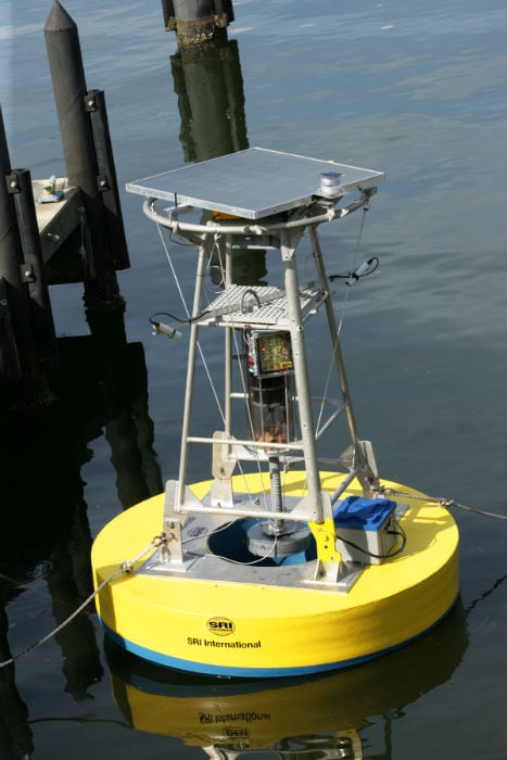
The Surface Module The Surface Buoy uses SB Data Acquisition and Communication System (SB-DACS); a magneto-inductive surface modem or the acoustic modem for the data link with the underwater unit and a satellite modem Inmarsat C for reliable data connection with the Onshore Centre (OC) a multi-parametric probe to monitor the main physical/chemical properties of the surface water layer
-
 5/7
5/7In Pics: Tsunami Warning System
Linking segment An “in water” communication segment connecting the Underwater Monitoring Module and Surface buoy is essential as the Underwater Monitoring module transfers data to the surface buoy which in-turn transfers it to the on-shore center
-
 6/7
6/7In Pics: Tsunami Warning System
Onshore Centre An Onshore centre (OC) hosting a standard PC server; analyses the data delivered from the Underwater Monitoring module and the onshore buoy
-
 7/7
7/7In Pics: Tsunami Warning System
Satellite Link A satellite communication segment is there for connections and link ups between the surface buoy and the Onshore center. All the data is transferred through this link and hence it is a critical part of the Tsunami warning system

![[Sponsored] Haier C90 OLED TV | Dolby Vision IQ, 144Hz OLED and Google TV in Action](https://www.gadgets360.com/static/mobile/images/spacer.png)


