- Home
- Internet
- Internet News
- Nasa, Japan Make 2.95 Million Satellite Earth Images Free
Nasa, Japan Make 2.95 Million Satellite Earth Images Free

"The public will have unlimited access to the complete 16-plus-year database for Japan's Ministry of Economy, Trade and Industry (METI) Advanced Spaceborne Thermal Emission and Reflection Radiometer (ASTER) instrument, which images Earth to map and monitor the changing surface of our planet," the US space agency said in a statement.
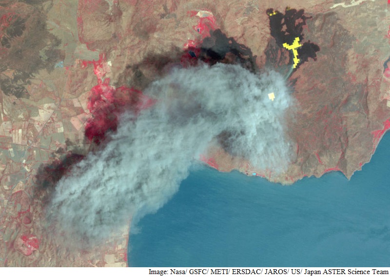
ASTER's database currently consists of more than 2.95 million individual scenes. The content ranges from the devastating aftermath of flooding in Pakistan to volcanic eruptions in Iceland and wildfires in California.
Previously, users could access ASTER's global digital topographic maps of Earth online at no cost, but paid METI a nominal fee to order other ASTER data products.
Launched in 1999, ASTER has far exceeded its five-year design life and will continue to operate for the foreseeable future as part of the suite of five Earth-observing instruments on Terra.
"We anticipate a dramatic increase in the number of users of our data, with new and exciting results to come," said Michael Abrams, ASTER science team leader at Nasa's Jet Propulsion Laboratory in Pasadena, California, home to ASTER's US science team.
ASTER is used to create detailed maps of land surface temperature, reflectance and elevation.
The instrument acquires images in visible and thermal infrared wavelengths, with spatial resolutions ranging from about 15 to 90 meters.
The broad spectral coverage and high spectral resolution of ASTER provide scientists in numerous disciplines with critical information for surface mapping and monitoring of dynamic conditions and changes over time.
Example applications include monitoring glacial advances and retreats, monitoring potentially active volcanoes, identifying crop stress, determining cloud morphology and physical properties, evaluating wetlands, monitoring thermal pollution, monitoring coral reef degradation, mapping surface temperatures of soils and geology, and measuring surface heat balance, Nasa said.
To access the data, users can visit the link.
Catch the latest from the Consumer Electronics Show on Gadgets 360, at our CES 2026 hub.
Related Stories
- Samsung Galaxy Unpacked 2025
- ChatGPT
- Redmi Note 14 Pro+
- iPhone 16
- Apple Vision Pro
- Oneplus 12
- OnePlus Nord CE 3 Lite 5G
- iPhone 13
- Xiaomi 14 Pro
- Oppo Find N3
- Tecno Spark Go (2023)
- Realme V30
- Best Phones Under 25000
- Samsung Galaxy S24 Series
- Cryptocurrency
- iQoo 12
- Samsung Galaxy S24 Ultra
- Giottus
- Samsung Galaxy Z Flip 5
- Apple 'Scary Fast'
- Housefull 5
- GoPro Hero 12 Black Review
- Invincible Season 2
- JioGlass
- HD Ready TV
- Laptop Under 50000
- Smartwatch Under 10000
- Latest Mobile Phones
- Compare Phones
- Red Magic 11 Air
- Honor Magic 8 RSR Porsche Design
- Honor Magic 8 Pro Air
- Infinix Note Edge
- Lava Blaze Duo 3
- Tecno Spark Go 3
- iQOO Z11 Turbo
- OPPO A6c
- Lenovo Yoga Slim 7x (2025)
- Lenovo Yoga Slim 7a
- Lenovo Idea Tab Plus
- Realme Pad 3
- Moto Watch
- Garmin Quatix 8 Pro
- Haier H5E Series
- Acerpure Nitro Z Series 100-inch QLED TV
- Asus ROG Ally
- Nintendo Switch Lite
- Haier 1.6 Ton 5 Star Inverter Split AC (HSU19G-MZAID5BN-INV)
- Haier 1.6 Ton 5 Star Inverter Split AC (HSU19G-MZAIM5BN-INV)


![[Sponsored] Haier C90 OLED TV | Dolby Vision IQ, 144Hz OLED and Google TV in Action](https://www.gadgets360.com/static/mobile/images/spacer.png)


