- Home
- Internet
- Internet News
- Google Street View to capture panoramic images of 100 Indian heritage sites
Google Street View to capture panoramic images of 100 Indian heritage sites
By Anupam Saxena | Updated: 3 October 2013 17:43 IST

Click Here to Add Gadgets360 As A Trusted Source

Advertisement
After running into trouble with local authorities in 2011, Google's Street View is back in India and this time the Internet giant has partnered with the Archaeological Survey of India (ASI) to create a 360-degree online imagery of 100 of India's most important heritage sites, including the Taj Mahal, Khajuraho Temple, and Ajanta and Ellora caves.
Google says that it will work with the ASI to bring the Street View Trekker, a wearable backpack with a camera on top, to 100 heritage sites in India for capturing imagery in remote sites or places accessible only by foot. The trekker was introduced in 2012 and features 15 lenses, each pointed in a different direction to create a 360-degree panoramic view. It is worn by an operator and is walked through pedestrian walkways or trails on foot and automatically captures images as it goes.
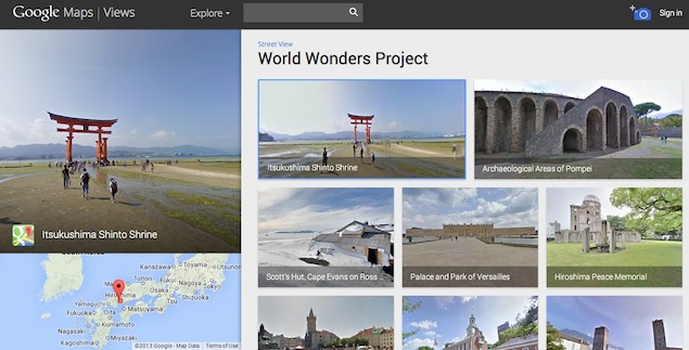
The 360-degree panoramic imagery would be available on Google Maps and on Google's World Wonders website after it's published, allowing people across the world to explore historical sites in India.
"In a country like India, where we have the worlds' second largest population and 5,000 years of history, rich in cultural diversity, technology can help us share the Indian experience with the rest of the world-and each other-more effectively than ever before. We're honoured to be working with the ASI to help make these important Indian heritage sites available for the world to experience online," said Rajan Anandan, Vice President and Managing Director, Google India.
It's worth pointing out that Google Street View covers everything from UNESCO world heritage sites, to places like Antartica, leading universities and even commercial establishments like Burj Khalifa.
In May 2011, Google had started collecting Street View data in India starting with the city of Bangalore through special cars fitted with camera equipment. However, after just one month, the Bangalore Police ordered Google to stop taking photos because of fears the images could be used by militants.
Comments
Get your daily dose of tech news, reviews, and insights, in under 80 characters on Gadgets 360 Turbo. Connect with fellow tech lovers on our Forum. Follow us on X, Facebook, WhatsApp, Threads and Google News for instant updates. Catch all the action on our YouTube channel.
Related Stories
Popular on Gadgets
- Samsung Galaxy Unpacked 2026
- iPhone 17 Pro Max
- ChatGPT
- iOS 26
- Laptop Under 50000
- Smartwatch Under 10000
- Apple Vision Pro
- Oneplus 12
- OnePlus Nord CE 3 Lite 5G
- iPhone 13
- Xiaomi 14 Pro
- Oppo Find N3
- Tecno Spark Go (2023)
- Realme V30
- Best Phones Under 25000
- Samsung Galaxy S24 Series
- Cryptocurrency
- iQoo 12
- Samsung Galaxy S24 Ultra
- Giottus
- Samsung Galaxy Z Flip 5
- Apple 'Scary Fast'
- Housefull 5
- GoPro Hero 12 Black Review
- Invincible Season 2
- JioGlass
- HD Ready TV
- Latest Mobile Phones
- Compare Phones
Latest Gadgets
- Tecno Pova Curve 2 5G
- Lava Yuva Star 3
- Honor X6d
- OPPO K14x 5G
- Samsung Galaxy F70e 5G
- iQOO 15 Ultra
- OPPO A6v 5G
- OPPO A6i+ 5G
- Asus Vivobook 16 (M1605NAQ)
- Asus Vivobook 15 (2026)
- Brave Ark 2-in-1
- Black Shark Gaming Tablet
- boAt Chrome Iris
- HMD Watch P1
- Haier H5E Series
- Acerpure Nitro Z Series 100-inch QLED TV
- Asus ROG Ally
- Nintendo Switch Lite
- Haier 1.6 Ton 5 Star Inverter Split AC (HSU19G-MZAID5BN-INV)
- Haier 1.6 Ton 5 Star Inverter Split AC (HSU19G-MZAIM5BN-INV)
© Copyright Red Pixels Ventures Limited 2026. All rights reserved.


![[Partner Content] OPPO Reno15 Series: AI Portrait Camera, Popout and First Compact Reno](https://www.gadgets360.com/static/mobile/images/spacer.png)


