Google Brings Map Maker to More Countries, Files Patent to Track Potholes

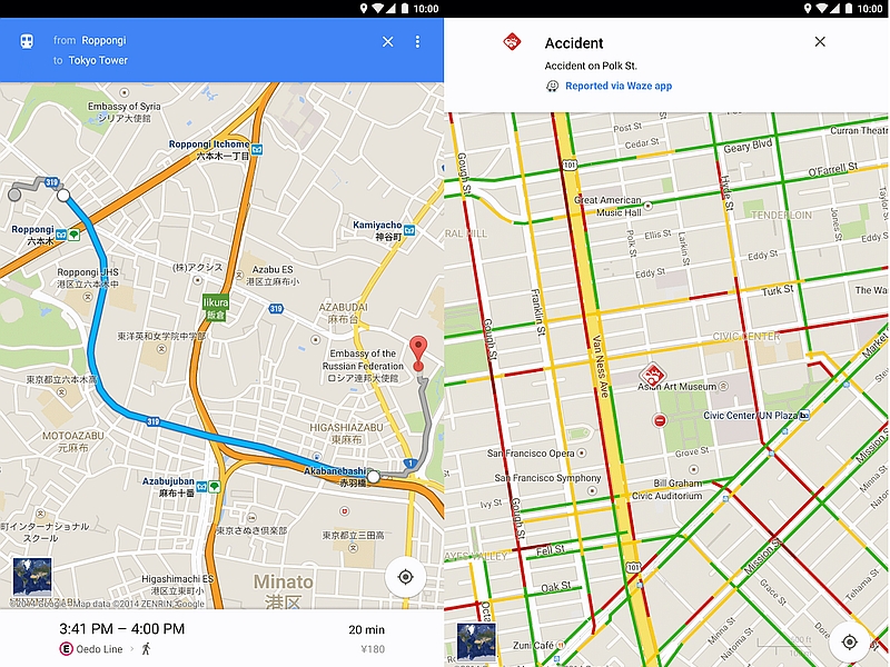
Following the re-opening of Google Map Maker in six countries earlier this month, Google has expanded the service to 45 more countries in the second-phase of its expansion. In the meanwhile, a report points to a patent filed by Google to track potholes on roads, creating a database and also giving alerts to drivers.
While Google announced the countries in the first phase of Map Maker's re-opening - India, Bangladesh, Brazil, Canada, Philippines and Ukraine - it has not detailed which countries make up the 45 more countries in the second phase. Pavithra Kanakarajan, Product Manager, Google Map Maker, in a product forum post explained the changes in the firms' crowd-sourced map making tool. These include Regional Leads, which are selected mappers in each country who will be able to moderate edits done by other mappers in their respective regions. She added that Polygon editing will now be unavailable. However, editing of other attributes such as names on polygonal features would be available.
The additional moderation by Google for its user-edited online map system has been added because of the embarrassment incident where an image of an Android mascot urinating on an Apple logo appeared on the Map for a brief period. Other high-profile incidences included a revision of the map of the White House in April to include a new business called "Edwards Snow Den," and later in May, a revision of the description of the White House with a racist term.
Google might be looking to bring more details in to its Google Maps section in future as it has filed a patent to track potholes on roads across the US, reports Gizmodo. The tracking of potholes will be done by using the car's GPS navigation system and other motion sensors. The patent details this data being filed into a database that will give alerts to drivers about bumpy and clean routes. It is worth mentioning that Google would keep track of various vibrations of the car using the sensors and would cross-check it with the GPS navigation system to determine if the car just went through a pothole or not. The data might later be used for its driverless cars or in Google Maps.
This idea by Google is not really new, as Boston has already been running such a programme since past few years, called Street Bump. In this, the local government keeps a database of the information crowdsourced by others and then assigns a team to fix the bump. Street Bump however, is an app and uses the driver's phone to collect data.
Catch the latest from the Consumer Electronics Show on Gadgets 360, at our CES 2025 hub.
Related Stories
- Samsung Galaxy Unpacked 2025
- ChatGPT
- Redmi Note 14 Pro+
- iPhone 16
- Apple Vision Pro
- Oneplus 12
- OnePlus Nord CE 3 Lite 5G
- iPhone 13
- Xiaomi 14 Pro
- Oppo Find N3
- Tecno Spark Go (2023)
- Realme V30
- Best Phones Under 25000
- Samsung Galaxy S24 Series
- Cryptocurrency
- iQoo 12
- Samsung Galaxy S24 Ultra
- Giottus
- Samsung Galaxy Z Flip 5
- Apple 'Scary Fast'
- Housefull 5
- GoPro Hero 12 Black Review
- Invincible Season 2
- JioGlass
- HD Ready TV
- Laptop Under 50000
- Smartwatch Under 10000
- Latest Mobile Phones
- Compare Phones
- Huawei Nova 13i
- Itel A80
- HMD Key
- Redmi Turbo 4
- Vivo Y200+
- Lava Yuva 2 5G
- OnePlus Ace 5
- OnePlus Ace 5 Pro
- Asus Zenbook S 14
- MacBook Pro 16-inch (M4 Max, 2024)
- Honor Pad X9 Pro
- Honor Pad V9
- boAt Enigma Gem
- boAt Enigma Daze
- Sony 65 Inches Ultra HD (4K) LED Smart TV (KD-65X74L)
- TCL 55 Inches Ultra HD (4K) LED Smart TV (55C61B)
- Sony PlayStation 5 Pro
- Sony PlayStation 5 Slim Digital Edition
- Blue Star 1.5 Ton 3 Star Inverter Split AC (IC318DNUHC)
- Blue Star 1.5 Ton 3 Star Inverter Split AC (IA318VKU)


