- Home
- Apps
- Apps Features
- How Google Maps Gets Its Remarkably Accurate Real Time Traffic Data
How Google Maps Gets Its Remarkably Accurate Real-Time Traffic Data

Google Maps is one of the most popular apps in the world, with well over a billion users. Google collects its mapping data from a wide variety of sources including road sensors, user contributions via Map Maker, and local transport departments, among several others.
Hidden away in Google Maps settings is the option to view traffic data for any location in real time. But how does Google collect this information, which is accurate to the last minute on most occasions?
Officially, Google says, “The traffic data comes from a variety of sources, including government departments of transportation and private data providers,” among other sources. But there's more to it than just that. When it comes to traffic data and associated predictions, Google Maps users also help it out, without even knowing they are doing so.
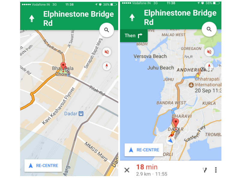
Ever noticed that when you are using Google Maps navigation to reach your destination, it gives you alternate routes, or informs you of some unexpected traffic? This is because the Google Maps app on Android and iOS constantly send back real-time traffic data to Google. The data received from any particular smartphone is then compared to data received from other smartphones in the same area, and the higher the number of Google Maps users in an area, the more accurate the traffic prediction.
Another source of traffic data are users of Waze app, which Google acquired in 2013 for $1 billion; Waze users feed information like accidents and traffic jams on their routes into the app, which Google can use to make your navigation experience more accurate.
Since launch, Google has collected enough data to be able to predict the kind of traffic users can expect on any road at any time of the day. So for example, Google would know that traffic would be at a peak in the morning and evening, but not on holidays.
Using the historical data it has compiled over the years and traffic data from mobile devices using the Google Maps app, the company is able to create models for traffic predictions for different periods. For example, the modelling techniques would be able to predict that certain roads would experience more traffic during rains than other times of the year. Google also takes traffic reports from transportation departments, road sensors, and private data providers to keep its information up to date.
Amanda Leicht Moore, the Group Product Manager for Google Maps, told Tech Insider that the historical data allows it to inform Google Maps users if traffic on their route is better or worse than it typically is, and how much they will be slowed down by accidents of slowdowns.
And in cases where traffic is causing slowdowns on the road but the route still remains the only way (or the fastest way) to a user’s destination, the Google Maps sends alerts detailing the reasons behind the delay as well as informing the user that this is still the fastest route they can take.
But the accuracy of location data is unmatched only because of its users, since the billion Google Maps users on the road act as sensors for the app, which make the service as precise as possible. Of course, you can opt out of it by turning off Location Services for Google Maps in Privacy on your iPhone or turning off Google Location History under Location in the Google Settings option.
How to Stop Google and Other Services From Tracking Your Location
But that would also leave your Google Maps app useless!
Get your daily dose of tech news, reviews, and insights, in under 80 characters on Gadgets 360 Turbo. Connect with fellow tech lovers on our Forum. Follow us on X, Facebook, WhatsApp, Threads and Google News for instant updates. Catch all the action on our YouTube channel.
Related Stories
- Samsung Galaxy Unpacked 2025
- ChatGPT
- Redmi Note 14 Pro+
- iPhone 16
- Apple Vision Pro
- Oneplus 12
- OnePlus Nord CE 3 Lite 5G
- iPhone 13
- Xiaomi 14 Pro
- Oppo Find N3
- Tecno Spark Go (2023)
- Realme V30
- Best Phones Under 25000
- Samsung Galaxy S24 Series
- Cryptocurrency
- iQoo 12
- Samsung Galaxy S24 Ultra
- Giottus
- Samsung Galaxy Z Flip 5
- Apple 'Scary Fast'
- Housefull 5
- GoPro Hero 12 Black Review
- Invincible Season 2
- JioGlass
- HD Ready TV
- Laptop Under 50000
- Smartwatch Under 10000
- Latest Mobile Phones
- Compare Phones
- Realme Neo 8
- OPPO Reno 15 FS
- Red Magic 11 Air
- Honor Magic 8 RSR Porsche Design
- Honor Magic 8 Pro Air
- Infinix Note Edge
- Lava Blaze Duo 3
- Tecno Spark Go 3
- HP HyperX Omen 15
- Acer Chromebook 311 (2026)
- Lenovo Idea Tab Plus
- Realme Pad 3
- HMD Watch P1
- HMD Watch X1
- Haier H5E Series
- Acerpure Nitro Z Series 100-inch QLED TV
- Asus ROG Ally
- Nintendo Switch Lite
- Haier 1.6 Ton 5 Star Inverter Split AC (HSU19G-MZAID5BN-INV)
- Haier 1.6 Ton 5 Star Inverter Split AC (HSU19G-MZAIM5BN-INV)


